Topographical Interface
A downloadable tool for Windows and macOS
Download NowName your own price
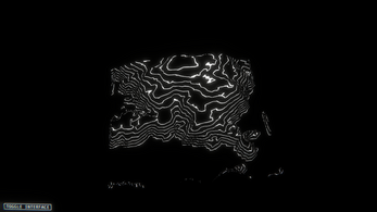
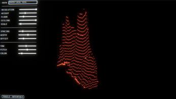
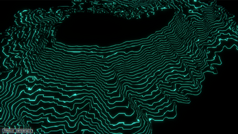
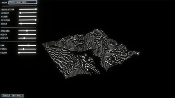
A heightmap visualizer to display as a 3D topographical map, with a thematic filter for a grainy and distorted screen. Intended to create materials for games of Mothership.
How To Use:
WASD controls the Yaw/Pitch sliders
Load a local grayscale jpg/png path to the text field to import a map
Use the sliders to customize your look
| Status | Released |
| Category | Tool |
| Platforms | Windows, macOS |
| Author | enceledean |
| Made with | Unity |
| Tags | heightmap, mothership, topography, Visualization |
| Average session | A few seconds |
| Inputs | Keyboard, Mouse |
Download
Download NowName your own price
Click download now to get access to the following files:
topo_interface_mac.zip 36 MB
topo_interface_win.zip 27 MB


Comments
Log in with itch.io to leave a comment.
hi, i download the program, but i encounter two problems :
+ i don't able to load the heightmap. The textbox it's tiny , can put a browse button ? for address folder ?
+ after i visualize the heightmap , for play also cities skylines, can put a save button with .jpg, or screenshot-button that i can save a area o .jpg or .png ?
thanks for yur program
ps : i use for play ttrpg , for zone my character :D bye
This looks awesome! Since this is done with Unity, is there any way you can generate a Linux binary?
Apologies, I currently only have access to a Mac computer to build with and it cannot create a Linux build.
Is the source code for this tool available anywhere?
At the moment, no. I am in the process of getting new equipment so will aim to make a Linux build soon, or decide whether to upload the source.
Thank you for taking my request seriously. I can try to compile a Linux binary, and I am also skilled in automated (CI/CD) build systems like Jenkins if either of these things seem helpful to you. I am not in a rush, I do have an OSX machine I can use in the meantime. Thanks!